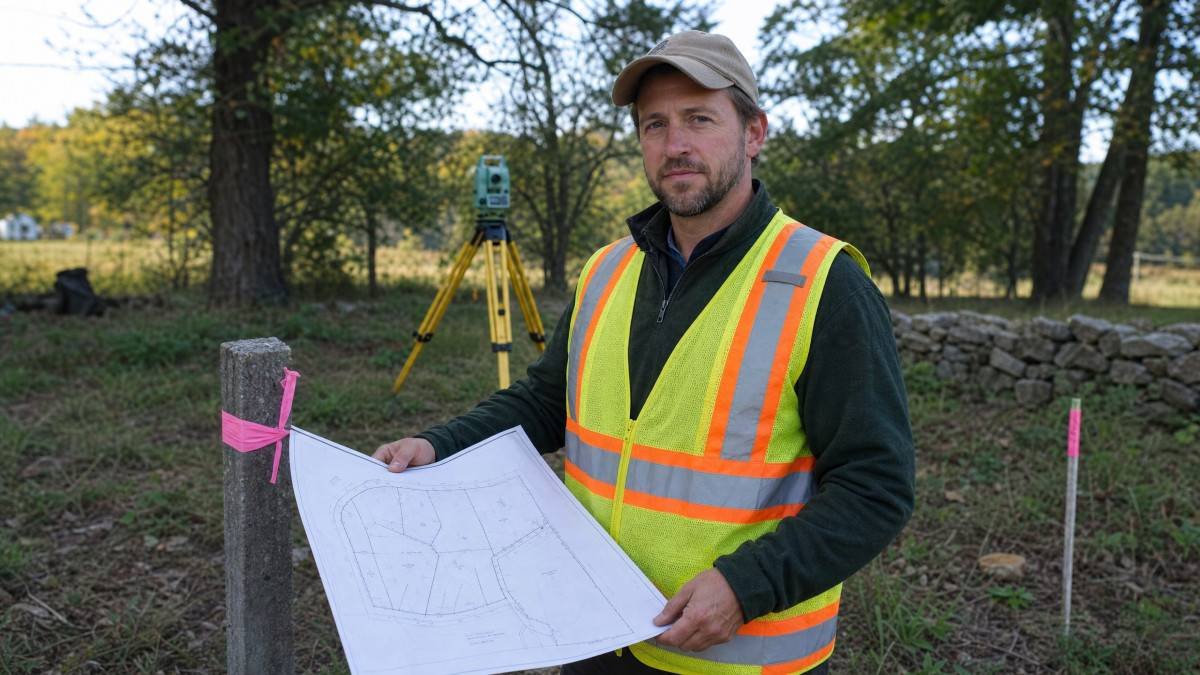
A property survey is a crucial document that defines the boundaries, features, and legal aspects of a parcel of land. For anyone involved in real estate, from prospective homeowners to seasoned investors, understanding how to interpret this technical drawing is paramount, explains Gregory Property Management, a trusted provider of property management in Bellevue WA. It provides a precise graphical representation of your property, detailing not just its perimeter but also any easements, encroachments, or improvements that might affect its use or value.
What is a Property Survey and Why is it Important?
A property survey is a legal document created by a licensed surveyor that accurately delineates the boundaries of a property, providing a detailed map of the land and its features. This document is critically important because it establishes the precise dimensions and location of your property, preventing potential boundary disputes with neighbors and clarifying legal rights. For instance, a survey might reveal an easement allowing utility companies access across your land, or it could identify a setback line dictating where you can build structures. Ignoring these details can lead to costly legal battles or force you to modify construction plans, potentially costing thousands of dollars in unexpected expenses. Typically, a survey will include information such as property lines, dimensions, existing structures, fences, driveways, easements, and any other physical features or legal encumbrances. Beyond just boundaries, a survey can also uncover potential issues like adverse possession claims, where a neighbor might have been using a portion of your land unchallenged for a period, potentially gaining legal rights to it. This makes the survey a proactive measure against future legal entanglements and a safeguard for your investment.
Key Elements to Look for on a Survey Map
When examining a property survey, several key elements demand your attention, as they provide a comprehensive understanding of the land’s characteristics and limitations. These include the property boundaries, which are often marked with specific bearings and distances, and any monuments or markers used by the surveyor to define these points on the ground. Additionally, look for easements, which grant specific rights to others over a portion of your property, and setbacks, which are minimum distances from property lines where structures can be built. For example, a survey might show a 10-foot utility easement along the rear of your property, meaning you cannot build a permanent structure within that strip. Identifying these features early can prevent future conflicts or costly mistakes, such as building a shed that encroaches on a neighbor’s land or violates local zoning ordinances. It’s not uncommon to feel a bit overwhelmed by the sheer volume of lines and numbers, but breaking it down into these core components makes it much more manageable. Understanding these elements is crucial for anyone planning to build, renovate, or even just enjoy their property without legal complications.
Understanding Property Boundaries and Dimensions
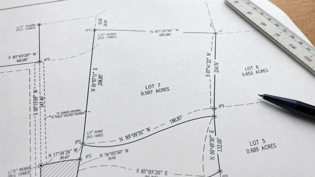
Property boundaries are the most fundamental aspect of any survey, defining the exact perimeter of your land. These are typically represented by lines with accompanying numerical data, such as bearings (directions like N 45° E) and distances (e.g., 150.25 feet). These precise measurements ensure that the property’s shape and size are accurately recorded. For instance, a boundary line might be described as “North 89 degrees 30 minutes 00 seconds East, 200.00 feet,” indicating a line running almost due east for 200 feet. It’s crucial to cross-reference these measurements with the legal description found in your deed to ensure consistency. Any discrepancies could indicate a problem with the survey or the deed itself, necessitating further investigation. Surveyors often use physical markers like iron rods, concrete monuments, or even natural features like trees to denote these corners on the ground, which are also typically noted on the map. These markers are the physical manifestation of the legal description and are vital for locating your property lines in the real world. Without them, identifying the exact limits of your property can be a frustrating and often contentious exercise, especially in older neighborhoods where original markers might have been disturbed or removed over time.
Identifying Easements and Encroachments
Easements are legal rights granted to another party to use a specific portion of your property for a particular purpose, while encroachments occur when a structure or feature from an adjacent property extends onto your land. Common easements include utility easements for power lines or sewer pipes, access easements for driveways, or drainage easements. For example, a survey might clearly depict a 15-foot wide sewer easement running through the backyard, meaning you cannot construct a swimming pool or a permanent shed in that area. Encroachments, such as a neighbor’s fence built a foot onto your property, can lead to significant disputes if not addressed. The survey will typically outline these areas with dashed lines or specific notations, making them identifiable. It’s vital to understand these limitations and potential conflicts before purchasing a property, as they can significantly impact your property rights and future development plans. Discovering an unrecorded easement after closing can be a particularly frustrating experience, potentially limiting your ability to develop or enjoy your property as intended. This is why a thorough review of the survey, ideally with legal counsel, is so important.
Common Symbols and Terminology on Surveys
Property surveys utilize a standardized set of symbols and terminology to convey complex information concisely, and familiarizing yourself with these conventions is essential for accurate interpretation. These symbols often represent physical features like buildings, fences, trees, and utility lines, while specific terms describe legal aspects such as easements, rights-of-way, and setback lines. For instance, a small circle with a cross might denote a utility pole, or a series of parallel dashed lines could indicate a drainage easement. Understanding these visual cues and their corresponding definitions is akin to learning a new language; without it, the document remains largely indecipherable. A legend or key is almost always included on the survey to explain these symbols, and taking the time to review it thoroughly can save a lot of confusion. It’s not always intuitive, and sometimes I find myself double-checking the legend multiple times for a single feature. Beyond the basic symbols, surveyors also use specific abbreviations, such as “R/W” for right-of-way or “P.O.B.” for point of beginning, which are critical for following the metes and bounds description of the property. A comprehensive understanding of these elements can demystify the survey and empower you to make informed decisions.
Deciphering Bearings and Distances
Bearings and distances are fundamental to defining property lines, providing the precise directional and linear measurements of each boundary segment. Bearings are expressed in degrees, minutes, and seconds, indicating a direction relative to North or South, such as “N 30° 15′ 20″ E” (North 30 degrees, 15 minutes, 20 seconds East). Distances are typically measured in feet and decimal feet, indicating the length of each boundary line. For example, a line described as “S 45° 00′ 00″ W, 100.00 feet” means the boundary runs 45 degrees west of south for exactly 100 feet. These measurements are critical for accurately plotting the property on a map and verifying its dimensions against legal descriptions. Errors in these figures can lead to significant boundary disputes, so careful attention to these details is warranted. According to the National Society of Professional Surveyors, accuracy in these measurements is paramount to avoid legal challenges and ensure clear property ownership [1]. It’s worth noting that older surveys might use different units or less precise measurements, which can sometimes create ambiguities when compared to modern surveys. This historical context can be a source of mild frustration when trying to reconcile conflicting information.
Understanding Contour Lines and Topography
Contour lines on a survey map illustrate the elevation changes across a property, providing a visual representation of its topography. Each contour line connects points of equal elevation, with closer lines indicating a steeper slope and widely spaced lines suggesting a flatter terrain. For example, if contour lines are spaced every five feet and you see several closely packed lines, you know that section of the property has a significant incline. This information is invaluable for understanding drainage patterns, planning construction projects, and assessing potential issues like erosion or flooding. A property with a steep slope might require extensive grading before building, adding considerable cost to a project. Conversely, a flat, well-drained parcel might be ideal for certain types of development. This topographical data can significantly influence the usability and value of a property, making it a critical component to analyze. For instance, a property with a natural slope away from the house might have excellent drainage, reducing the risk of basement flooding, whereas a property with a depression could be prone to water accumulation. Understanding these nuances can save homeowners from unexpected expenses and headaches down the line.
How to Verify the Accuracy of a Survey
Verifying the accuracy of a property survey is a critical step, as even minor errors can have significant legal and financial repercussions. One of the primary methods is to compare the survey with the legal description of the property found in your deed or title report. Discrepancies between these documents should be investigated immediately, as they could indicate a problem with either the survey or the legal description itself. Additionally, physically inspecting the property for the monuments or markers indicated on the survey, such as iron rods or concrete pins, can help confirm the boundaries. If these markers are missing or appear to be in different locations than depicted, it warrants further inquiry with the surveyor. Consulting with a local land surveyor or a real estate attorney can also provide an independent review of the survey’s accuracy and help identify any potential issues. It’s not uncommon for older surveys to be less precise due to older technology, or for markers to have been moved over time, leading to potential conflicts. This due diligence can prevent future boundary disputes or challenges to your property rights.
Frequently Asked Questions
Q: What is the difference between a boundary survey and a topographic survey?
A: A boundary survey primarily focuses on defining property lines and corners, while a topographic survey details the elevation changes and natural and man-made features of the land.
Q: How often should I get a new property survey?
A: It’s advisable to get a new survey whenever you purchase a property, plan significant construction, or suspect a boundary dispute, as property conditions and legal requirements can change over time.
Q: Can I rely on an old property survey?
A: While an old survey can provide historical context, it may not reflect current conditions, new easements, or updated legal descriptions, making a new survey generally more reliable for current transactions.
Q: What should I do if my survey shows an encroachment?
A: If your survey reveals an encroachment, it’s best to consult with a real estate attorney to understand your legal options and negotiate a resolution with the encroaching party, which might involve removal, an easement agreement, or purchase of the encroached land.
Q: Who is responsible for ordering a property survey?
A: Typically, the buyer is responsible for ordering a property survey during a real estate transaction, though sometimes the seller may provide an existing one, which should still be reviewed carefully.
Conclusion
Navigating the intricacies of a property survey can seem daunting at first, but with a methodical approach to understanding its key components, you can unlock a wealth of critical information about your land. From precisely defined boundaries and dimensions to the identification of easements, encroachments, and topographical features, each element plays a vital role in establishing your property rights and informing future decisions. Taking the time to meticulously review this document can prevent costly legal issues, ensure smooth construction projects, and ultimately provide peace of mind regarding your investment. It’s a small investment of time that can yield significant returns in clarity and security, ensuring you truly know what you own. Ultimately, a property survey is more than just a map; it’s a critical legal document that empowers you with the knowledge to protect your property and make informed choices about its future.
References
[1] National Society of Professional Surveyors. “Why You Need a Professional Land Surveyor.” https://www.nsps.us.com/page/WhyYouNeedALandSurveyor